Cartography of Ireland since the 16th century: a map morphing experiment
Interest in cartography is a common thing online nowadays, so there is one thing I was surprised not to find easily: map morphing animations. For example, to show the evolution of maps along history. This sounds obvious once you think about it, but apparently this hasn’t been done so often. This great North America animation is the only example I’ve found. So I did it myself.
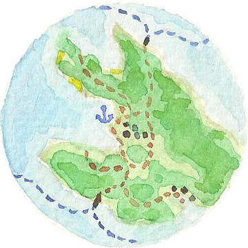
Here is my first try, with Ireland.
I chose Ireland for a lot of reasons. Being an island, it is a limited territory where only natural borders need to be considered. Being relatively small, it’s not subject to big distorsions due to different projections. It has some very distinctive geographic features, like a complex coastline and many great lakes. That would make matching easier between different maps, and differences appear more clearly. The history of Ireland cartography is also really interesting, with very different early maps, and a dramatic turn by the end of the 17th century. Last but not least, I love this country and know it well firsthand (I’ve just returned from ten days there driving round the island for the second time).
Disclaimer: Please bear in mind that this is just a cartographic and visual experiment, so it lacks the rigor of an historian work. Some dates may be wrong, and as I had to use some lo-res images with barely readable place names, a lot of matches in early maps are probably off. Please excuse any error you may find, and feel free to report them. I would love to have the time and resources to do it more rigorously.
Here are the sources I used:
- The University College Dublin Library map collection ;
- The ever wonderful David Rumsey map collection ;
- The Down Survey, on the Trinity College site ;
- An adapted style in Mapbox studio to showcase OpenStreetMap ;
- And a lot of raw Google Images searches to sites I didn’t note. Sorry :/
Some nice things to note
-
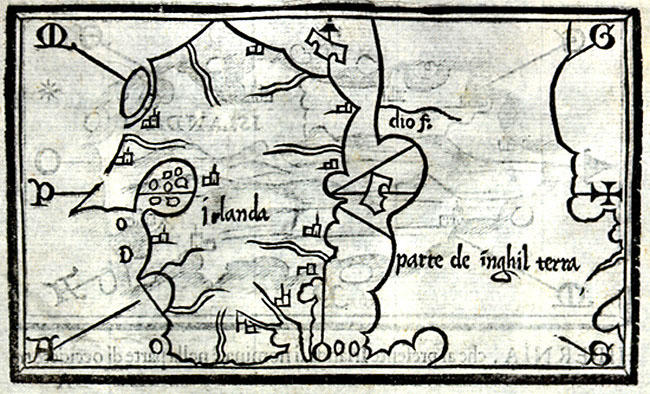
Four of the earliest maps are rotated 90°, as they present the west on the top. This is from a time where the north-on-top convention wasn’t so fixed as it is today1, and the elongated shape of the island as known then fitted adequately on atlases’ double-pages.
-
Starting from the Mercator map, there are three large isles near the south-east coast:
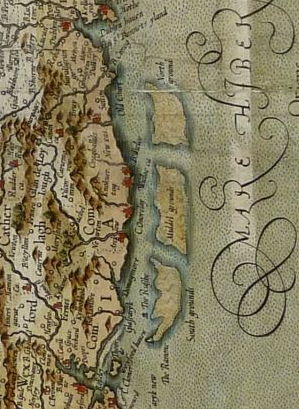
You can clearly see them on the next two maps, and they appear more and more evanescent on the next ones, before disappearing completely.
These islands don’t exist nowadays. At first I thought this was an example of bogus information transmitted from map to map. But I did some research and found old mentions of large sandbanks on the east coast from Dublin to Wexford (here in a French book). This must be it, exaggerated on early maps probably because it was a well-known threat for navigators.
-
Another feature I like on early maps is this enormous lake in the north part of the country, which looks like an eye in a strange face. This is actually the Lough Erne, two large-but-not-that-much connected lakes, with a complex shoreline and many scattered islands. It clearly trumped ancient cartography methods.
-
Seeing for how long it was underestimated, the region corresponding to current county Mayo and the Connemara also seems to have been quite hostile to cartographers for a long time :).
-
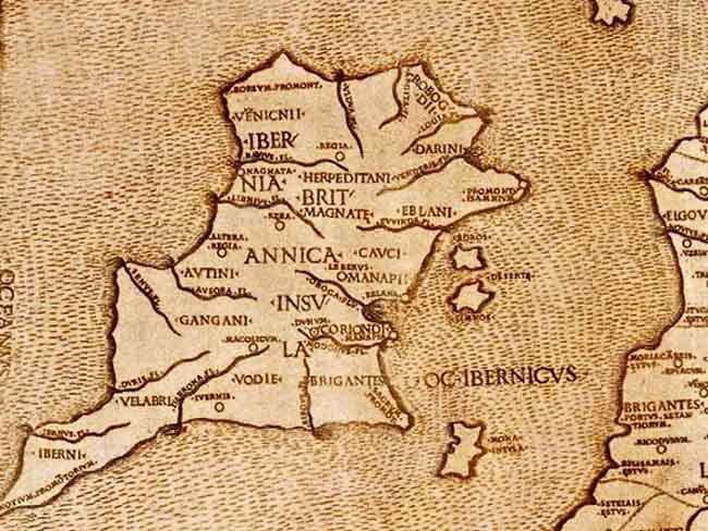
As you can see, the problem of accurate mapping of Ireland was pretty much solved as early as 1656 by the Down Survey. Undertaken after Cromwell’s conquest of the island, it was the first cartographic survey ever done at this scale in the world. It was a huge leap forward in accuracy, making all previous maps seem obsolete, especially to our modern eyes. Focused on land ownership, it included far more than just a general map of the country, as you can see on the dedicated website hosted by the Trinity College of Dublin.
Earlier maps
Of course there are maps of Ireland before 1566. Like this one:
… or this one:
… and many atlases and ancient navigation maps, where Ireland appears as a rough shape. But these maps are so far from the real thing that it’s hard to work with them. I tried a bit, but I didn’t know where to put the matching points and the morph rendering was terrible. So I started from the first map I found where some disctintive features begin to be clearly recognizable. Maybe it’s worth a try with another morphing software?
Technical note
As a believer of free and open source software, I use free tools in all that I do. And because I’m stubborn, I continue to do so even when it borders on masochism :)
To achieve the morphing animation, I used Gimp and GAP, a quite outdated plugin for Gimp which adds animation capabilities. It includes a morphing tool which works by defining matching points between two images. Then it outputs morphing steps as a specified number of layers.
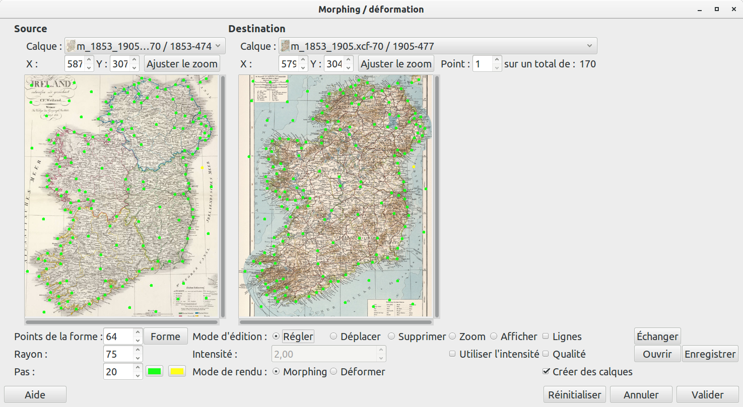
To achieve a smooth transition, you need to define a lot of points, which I did between each pair of maps. I won’t lie, it was tedious. Mainly because GAP is unstable and has a lot of UI gotchas. But after 3 or 4 maps done, I was really productive :).
I then used a ffmpeg command line to get a video from all the image frames. The editing work (adding captions to the video) was done with Kdenlive, which is quite good, especially compared to the other video applications on Linux. Et voilà !
Morphing in general seems rather old-school now, looking like something from the 90’s, so there isn’t a lot of available software. But I’m pretty sure there are easier alternatives to the process. So if you know of some tools that could help, even non-Linux non-free, feel free to comment.
Anyway, I hope you enjoyed it :)
Footnotes
-
There is a great article about the history of the north-on-top convention on America Al Jazeera. ↩